Contour lines give an idea of relief in topographic maps. They are lines that join points with the same height with regard to level 'zero' reference, in most cases sea level (A). These lines (H) represent the intersection between relief and horizontal planes that are equidistant to the reference level (G).
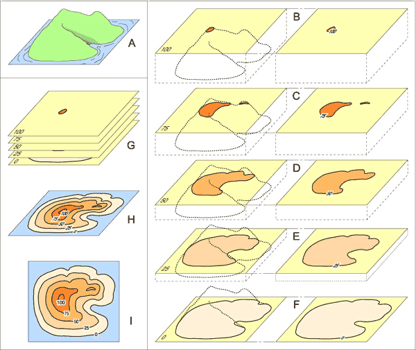
Each of these lines projected on the plane of the drawing (B-F) constitute the basis of topographic maps (I). This representation obviously requires selecting a determinate number of planes according to the accuracy wanted and especially the scale of the map.
To make an effort is necessary to analyse the relief beginning with the shape of the contour lines drawn on the map. You will have to understand how these lines are generated.
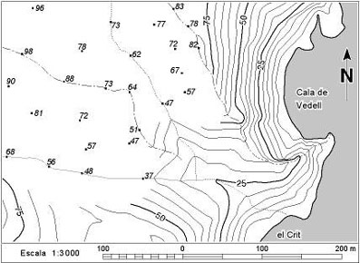
As can be proved, contour lines never cross each other and their spacing on the map is different from an area to another. It is also probable that your answer shows that contour lines near the valleys have a V-shape, with the vertex pointing upstream. Concentric and more or less closed contour lines will show a mountain or a depression, depending whether their value increases or decreases respectively to the centre.
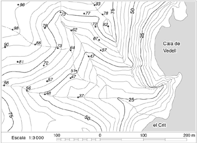
Since the distance between a line and the next one is always the same in reality (equidistance), their projection on the map will give an idea of relief. If contour lines are very close (cliffs on coastline) they indicate a steep relief. If they are spaced (rest of the map) they indicate a smoother relief. You must remember that the height difference between successive lines is always the same. That is the reason why all topographic maps show relief with lines that always have a value multiple of a number known as equidistance. Choosing this equidistance is obviously influenced by the size of the map and especially by its scale. Well understanding this concept is essential to solve problems related to geological maps.