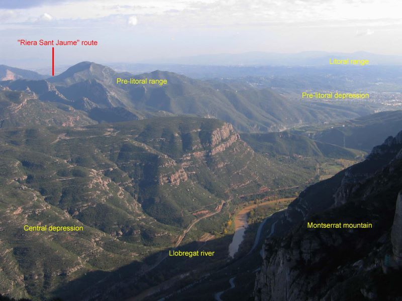
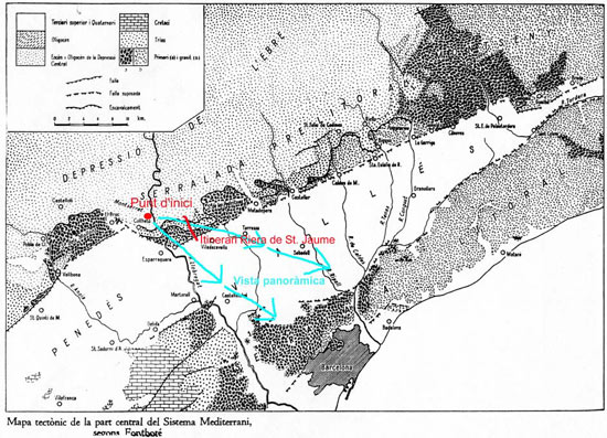
This will allow us to introduce main relief units defined in the environment where we are and also place the areas that we want to visit in this geological context.
To help us introducing units of relief we can use a map where students could see these units layout and connect them with what is being observed.
The example that we propose shows the link between Catalonia’s central area relief units (Coastal Catalan Chains and Central Depression) and also with one of the classic routes such as the one of Riera de Sant Jaume.


