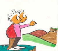
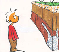
The following sketch shows the guideline proposed. It is a question of analysing as a zoom, starting from delimiting the area that we want to study in main geologic units and then analysing the outcrops. Every outcrop will have to be placed following the map and the general description of the area. The geological study of the outcrop will be started with its observation from a distance that allow us to distinguish its different units. After this, we will approach to analyse each of the defined units and its materials. Finally, we will draw the outcrop cross section and will interpret it. Information given after studying several outcrops will give us a geologic view of the studied area.
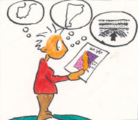
These are the steps to follow: (see sketch)*


*Segons Bach, J.; Brusi, D.; Domingo, M. y Obrador, A. (1988). Propuesta de una metodología y jerarquización de las observaciones del trabajo de campo en Geología. Henares: Revista de Geología, 2: 319-325