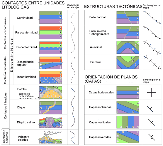
Another element of the geological map is the type of contact that exists between each one of the mapped units, that is, between each one of the different colours of the map. A contact, in a map, is the resulting line of the intersection between the surface that separates the two groups of rocks mapped and topography. Several types of contacts can be defined according to the rocks and processes that have caused them. They can be seen schematically as small geologic cross sections in the attached figure.
To know what dotted lines in the map mean we only have to have a look at the legend: in our example (see Geological map) the line represents a concordant contact. This entails a parallelism between two groups of superposed stratified rocks. This parallelism does not always mean conformity. That is why it is possible to find in a map many kinds of concordant contacts. Very often two groups of rocks can keep their parallelism and have a stratigraphic break either by erosion or non deposition. For example, paraconformities represent concordant contacts where an important time interval is missing (because of non sedimentation.) You should have another look to the legend of the map and pay attention to the age of the rock because this layout can give a false appearance of continuity.